
Urban regional network puno dwg
.")
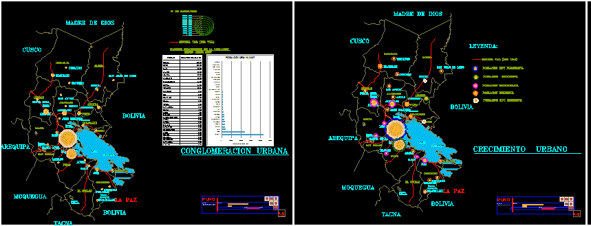
This work contains the route of the region with all provinces puno, each containing the plans first first top 30 most populated cities with population respective owner pictures of influence your radio your relationship of trade flows , road, economic, social, cons, cities according to degree of influence. other inside each of influence as radios hierarchical position within the region as well as your location, and its relation tecero flow and referred to as the location of each of these, in conclusion this is to show work of completed the behavior of urban centers and / or most populated cities in the region of puno with each of the characteristics of population, pea, age groups, employment growth rate and other services with regard to the region of puno.